NavSight
Beyond GPS: precision navigation on a smartphone when conventional GPS positioning is unavailable or unreliable.
Navigation without relying on GPS.
Satellite positioning can be disrupted or unavailable. NavSight is an engineering capstone about precision navigation under that kind of GNSS disruption, running on a smartphone.
The approach combines visual-inertial odometry with offline HMM map matching.
Approach
- Smartphone-based navigation
- GPS-denied environments
- Visual-inertial odometry
- Offline HMM map matching
Two techniques, in general terms.
Visual-inertial odometry
Estimates how a device is moving by combining camera images with inertial sensor data, without relying on satellite positioning.
HMM map matching
Aligns an estimated movement track with a map using a hidden Markov model. The project describes its approach as offline HMM map matching.
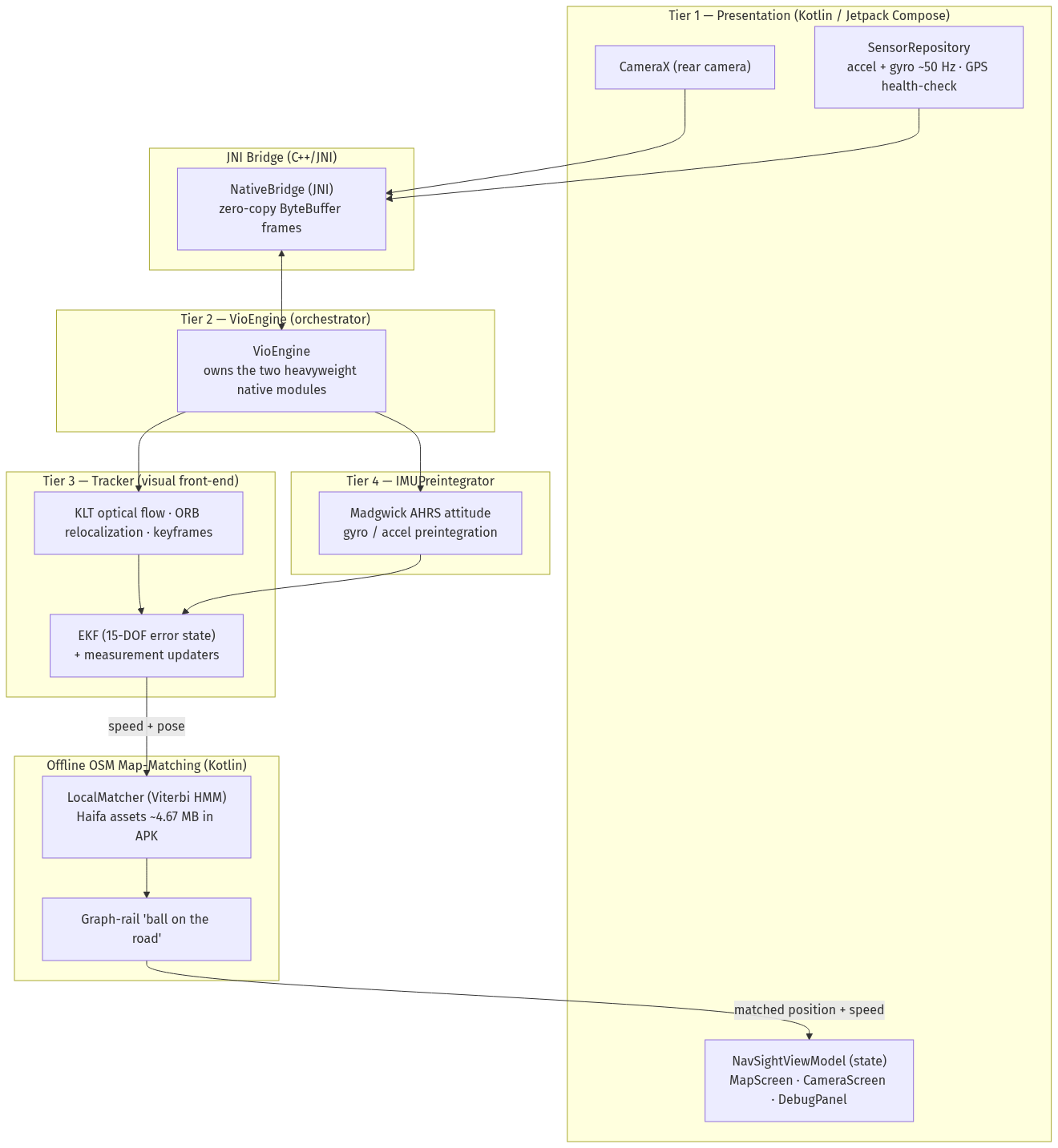
Camera, inertial sensors and offline map matching in one pipeline.
Measured on real urban rides under GNSS disruption.
The public project repository reports travelled-distance accuracy of 91% to 93%, median moving speed within 3.5% of the reference, and 13 of 13 system test cases passing.
On a route where jammed GPS overstated distance by 33%, NavSight remained within 7% of the map-measured reference.
Engineering details
- Android application with C++ visual-inertial core
- Camera + accelerometer + gyroscope
- Error-state EKF and MSCKF updates
- Offline OpenStreetMap road graph
- Deterministic replay harness for validation
Final report and public repository.
The student final report, and the public repository with source code, architecture documentation and validation assets.
Engineering capstone, Shenkar Software Engineering, 2026.
Built by Roey Ben Harush, Tamir Sobuh and Morad Zubidat.